The intention with this website is to locate at least 1,001 benchmark sites, or die in the attempt (no flowers please, house private). Photos of any benchmark sites found will be posted at intervals over the coming days, weeks, months, years, decades, centuries ... Anyone who wishes to contribute can send photos and descriptions of any benchmarks they find and would like to have included here, to mfbourke@gmail.com See post Number 1 for a fuller description.

Hit Counter

Saturday, October 5, 2013

NUMBER 694

BENCHMARKS continued


Once upon a time there was just one road in Dublin City called Pidgeon House Road. In a way that mirrors Pakistan when first established, there are now two Pidgeon House Roads. With Pakistan the two parts of the country were separated geographically by the huge landmass that is India; while the two Dublin roads are separated by about 400 metres of a massive freight depot that was plonked down there on a part of the original single road. The result today is that anyone wishing to travel from one road to the other must navigate there via three other differently named roads. It almost goes without saying but this is likely to result in confusion in the mind of anyone unaware of this state of affairs and seeking directions to either of the pair of similarly named roads. Benchmarker is seldom one to editorialize but surely it is well past time to give each of the two roads a different designation. Benchmarker's suggestion to the City fathers and mothers is to designate the two roads as 'West' and 'East' as appropriate. Developments in this regard are eagerly awaited.
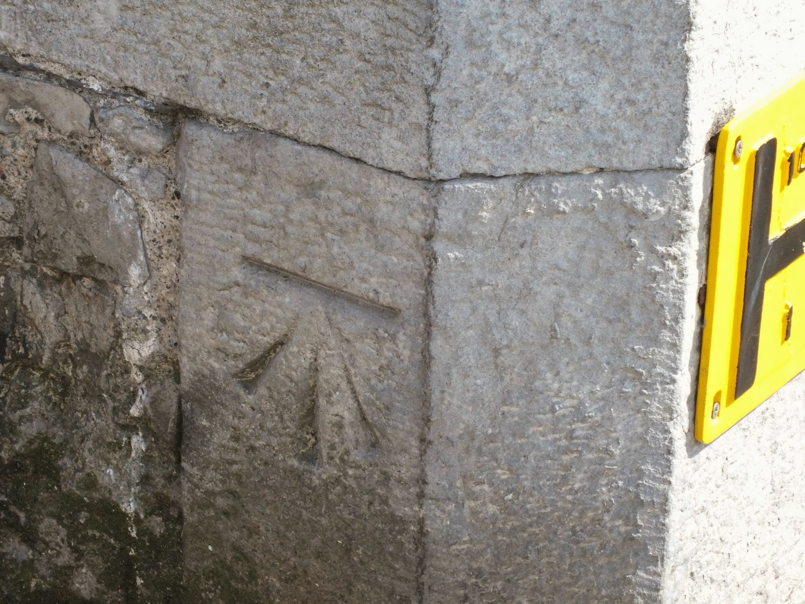
This one is on the north side of that terrace of buildings known as the Coastguard Station on Pidgeon House Road West in Dublin City.


Below: The 'mark on the Coastguard Station. Unfortunately this photo is of poor quality as a result of the low light level at the time of its taking.
 
 Above: A view of the northern side of the main building of the terrace on Pidgeon House Road West. The 'mark is at bottom right of the peaked roofed section of the main building, hidden in the vegetation.

Friday, October 4, 2013

NUMBER 693

BENCHMARKS continued


This one from the South Bull Wall is a little east of the Half Moon Battery just a bit past where the wall veers towards the north-east. Sorry it is not more specific.


Below: A 'mark on the South Bull Wall, Dublin City. It's about 300 metres west of the Lighthouse.
 
 Above: Looking east on the South Bull Wall with the 'mark at bottom centre, in the shade of Benchmarker's massive shadow. (In reality the Lighthouse does not lean; the effect is a result of the wide angle lens.)

NUMBER 692

BENCHMARKS continued

A hidden-in-plain-sight little gem in the city centre that is a popular promenading spot for some in-the-know Southside Dubliners is the South Bull Wall leading out to the Poolbeg Lighthouse. However unlike its counterpart on the Northside - the Bull Wall - a visit to there by road requires navigating an ugly and extensive industrial complex. Benchmarker is usually not one to editorialize but surely the City fathers and mothers should make this lovely spot more accessible and more widely popular by constructing a new roadway to bypass that great big mass of power stations, sewerage works, shipping container depots etc. (This message was approved by M.C.)

Below: A 'mark on the South Bull Wall, Dublin City. It's about 200 metres west of the Lighthouse near a set of steps.
 
 Above: Looking east on the South Bull Wall with the 'mark at bottom left.

Thursday, October 3, 2013

NUMBER 691

BENCHMARKS continued

This one from Belfast is on Howard Street on the west side of its junction with Upper Queen Street.

Below: The 'mark on Howard Street, Belfast.
 
Above: Looking west on Howard Street with the 'mark at bottom right.

Wednesday, October 2, 2013

NUMBER 690

BENCHMARKS continued

(The number of this 'mark is coincidental and in no why whatsoever related to events in the past, so its nat.) Last July Benchmarker temporarily slipped away from M.C. and the Drogheda campaign to launch a solo effort north of the border in Belfast. The result - two 'marks - is not encouraging for further forays thereabouts. The first of these is on a building on the south side of North Street at its junction with Gresham Street.

Below: The 'mark on North Street, Belfast.
 
Above: Looking east on North Street with the 'mark at bottom right.


Tuesday, October 1, 2013

NUMBER 689

BENCHMARKS continued


This one from Drogheda is on the south west corner of Fair Street.


Below: The 'mark on Fair Street, Drogheda, County Louth.
 
 Above: Looking east into Fair Street with the 'mark at bottom right.

NUMBER 688

BENCHMARKS continued

On Thomas Street in Drogheda at the entrance to Cord Cemetery is this one.

Below: The 'mark at the entrance to Cord Cemetery on Thomas Street, Drogheda, County Louth.
 
 Above: The entrance to Cord Cemetery with the 'mark at the bottom of the gate pillar at left.

NUMBER 687

BENCHMARKS continued

This one from Drogheda is under the railway bridge on the east side of Beymore Road.

Below: A 'mark on Beymore Road, Drogheda, County Louth.
 
 Above: Looking north on Beymore Road with the 'mark at bottom right.

Blog Archive